
In 2007 and 2008, the U.S. Department of Energy (DOE) designated 25 major U.S. cities as Solar America Cities and provided financial and technical assistance to help the cities develop comprehensive approaches to increasing solar energy use. The federal-local partnerships have enabled DOE to identify barriers to solar energy use in diverse locations and at various stages of market development, and to collaboratively develop solutions to those barriers.
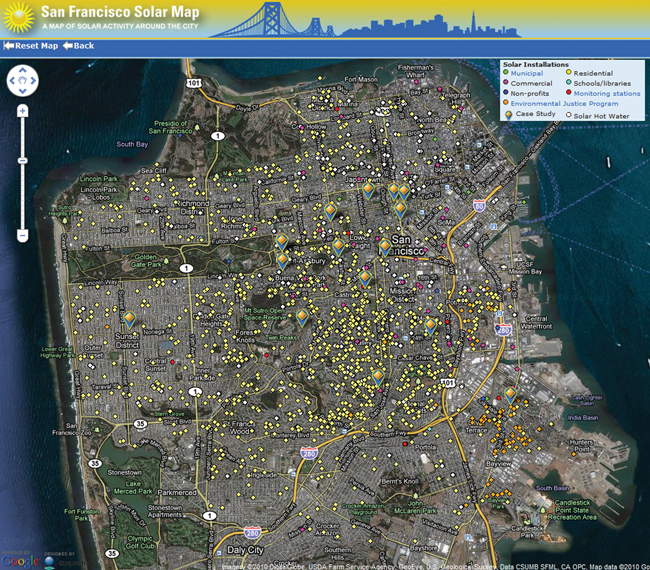
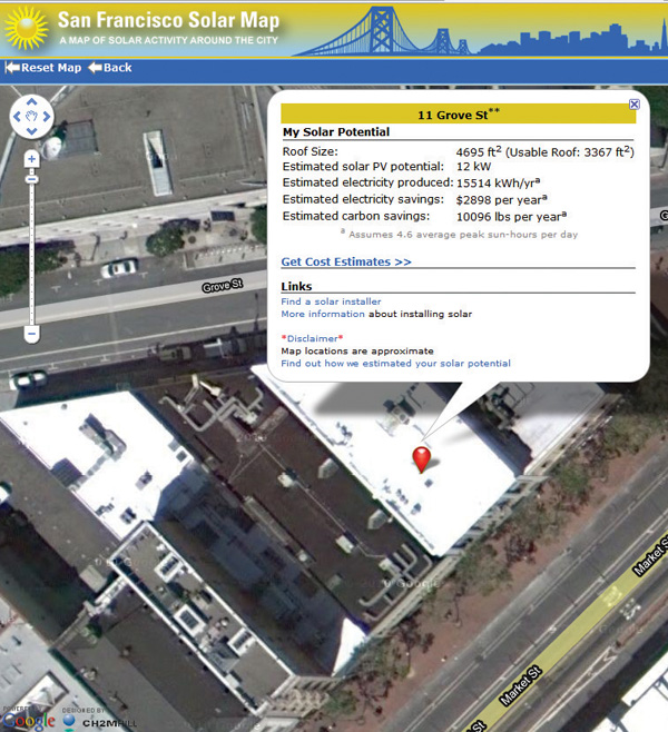
Shown here is a ‘solar map’ on San Francisco’s website. The website explains that markers identify existing solar installations in the City. Online users can click on a marker on the map to pull up information about that solar installation. To see a building’s rooftop solar potential, type in the address in the address line indicated in the bar at the right hand side of the screen. (Example provided is 11 Grove St., see insert.) Data provided include an estimate of the rooftop’s solar PV potential, estimated annual system output and associated energy savings, and estimated annual CO2 emissions mitigated.
San Francisco in 2007 was the first to provide such a map, but it has been joined by Boston, Los Angeles, Portland, Oregon, Salt Lake City and Denver. New York’s version is to launch in early 2011. San Francisco set a goal of 10,000 solar rooftops city-wide by 2010.
The map shown is at http://sf.solarmap.org/. The DOE website is at http://solaramericacommunities.energy.gov/Cities.aspx